Living in or near Pisgah Forest, NC (zip code 28768) offers stunning natural beauty, but it also comes with its share of environmental challenges—flooding being one of the most significant. As weather patterns shift and development changes the landscape, understanding flood zone trends in this area has never been more important. Whether you’re a homeowner, prospective buyer, or local policymaker, staying informed about how flood risks are evolving is crucial for safety, property protection, and community planning. In this article, we’ll dive into the latest flood zone trends affecting Pisgah Forest and what you need to know to stay prepared.
Table of Contents
- Understanding Flood Zone Classifications in 28768 Pisgah Forest and Their Implications
- Recent Changes in Flood Patterns and What They Mean for Homeowners
- Assessing Property Risks and Insurance Requirements in Pisgah Forest
- Practical Steps for Flood Preparedness and Mitigation in High-Risk Areas
- In Conclusion
Understanding Flood Zone Classifications in 28768 Pisgah Forest and Their Implications
In 28768 Pisgah Forest, flood zone classifications serve as critical indicators for homeowners, developers, and local authorities alike. These classifications, designated by the Federal Emergency Management Agency (FEMA), determine the risk levels of flooding based on historical data, topography, and hydrologic patterns. Areas marked as Zone A or Zone AE are deemed high-risk flood zones, meaning properties within these boundaries are more susceptible to flooding during heavy rains or storm surges. Conversely, Zone X (shaded) and Zone X (unshaded) denote moderate to minimal risk, respectively. Understanding where your property lies within these zones directly impacts flood insurance requirements and building regulations, influencing long-term safety and financial planning.
Being well-informed about these zones offers numerous practical benefits, especially considering the increasing variability in weather patterns affecting Pisgah Forest. For residents and potential buyers, the classification can affect:
- Insurance premiums and coverage options, often making high-risk zones more expensive to insure
- Property values and resale potential, as flood risk factors into market desirability
- Mitigation efforts, such as elevation of structures or installation of flood barriers that may be mandated in higher-risk zones
- Emergency preparedness plans tailored to the likelihood and severity of flood events specific to each zone
Recent Changes in Flood Patterns and What They Mean for Homeowners
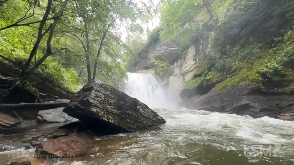
Over the past decade, Pisgah Forest has witnessed a noticeable shift in flood patterns, driven largely by changing climate conditions and increased urban development. Traditional flood zones are expanding, with areas once considered low-risk now experiencing higher water levels during storms. For homeowners, this means that the boundaries of flood insurance requirements and emergency preparedness zones are evolving. Weather events are becoming more intense and unpredictable, with heavier rainfall concentrated in shorter periods, often overwhelming local drainage systems and natural waterways. Staying informed about these developments is crucial, as relying on outdated flood maps can lead to insufficient protection and costly damages.
Homeowners should consider several key factors to adapt to these changes:
- Reassessing property elevation: Areas previously deemed safe might require additional flood-proofing measures.
- Updating insurance coverage: Flood insurance policies should be reviewed regularly to reflect current risk levels and prevent significant out-of-pocket expenses.
- Implementing landscaping changes: Strategic planting and proper grading can help divert water flow and reduce soil erosion.
- Engaging with local floodplain management: Community initiatives and updated zoning regulations can provide new opportunities for resilience.
Understanding these dynamic flood patterns not only protects individual investments but also contributes to the broader safety and sustainability of Pisgah Forest neighborhoods.
Assessing Property Risks and Insurance Requirements in Pisgah Forest
When evaluating properties in the 28768 area, understanding the flood risk is crucial for both homeowners and investors. The Pisgah Forest region has experienced subtle shifts in flood zones due to recent climate patterns and updated FEMA maps. Properties sitting near creeks, rivers, or low-lying areas may now fall into high-risk flood zones, impacting insurance requirements and overall safety. It’s essential to review the latest flood plain maps and consult with local authorities or specialized surveyors to accurately assess each property’s vulnerability to flooding.
Insurance in Pisgah Forest must be tailored to these evolving risks. Standard homeowner policies often exclude flood damage, so securing a separate flood insurance policy is recommended in many parts of 28768. Factors to consider include:
- Elevation certificates: Verify if your property’s elevation reduces flood risk.
- Mold and water intrusion coverage: Ensure your insurer offers options or riders for lingering water damage.
- Premium fluctuations: Prepare for insurance premium changes as flood zones are updated.
Being proactive with risk assessment and insurance planning can save property owners significant costs and stress in the future.
Practical Steps for Flood Preparedness and Mitigation in High-Risk Areas
In areas like 28768 Pisgah Forest, where the risk of flooding is increasing due to shifting weather patterns, taking proactive measures can make a significant difference. Start by conducting a thorough assessment of your property’s vulnerability to floodwaters. This includes checking for low-lying areas, ensuring proper drainage systems are in place, and evaluating the integrity of foundations and basement walls. Investing in flood-resistant building materials and installing backflow valves can prevent water from entering your home’s plumbing system. Additionally, creating an emergency supply kit equipped with essentials—such as bottled water, non-perishable food, flashlights, batteries, and important documents in waterproof containers—will enhance your preparedness during critical moments.
Community involvement also plays a crucial role in mitigating flood impacts. Collaborate with neighbors to develop neighborhood watch programs that monitor flood alerts and share vital information promptly. Engaging with local authorities to stay updated on evacuation routes and municipal flood control initiatives ensures you are part of a coordinated response effort. Simple landscaping techniques, like planting native vegetation or constructing rain gardens, can reduce runoff and improve soil absorption. Moreover, staying informed through reliable weather services and flood warning systems provides the lead time needed to secure property and safeguard loved ones effectively.
- Regularly inspect and maintain gutters and storm drains.
- Elevate electrical appliances and utilities above potential flood levels.
- Develop a family evacuation plan tailored to local flood risks.
- Purchase flood insurance, even if not mandated.
In Conclusion
Understanding flood zone trends in 28768 Pisgah Forest, NC, is crucial for residents, homebuyers, and local planners alike. As climate patterns shift and development changes the landscape, staying informed about flood risks can make all the difference in preparedness and safety. Whether you’re considering a move, investing in property, or simply want to protect your current home, keeping an eye on updated flood maps and local regulations is essential. By staying proactive and well-informed, the Pisgah Forest community can better navigate the challenges ahead and work toward a safer, more resilient future.

